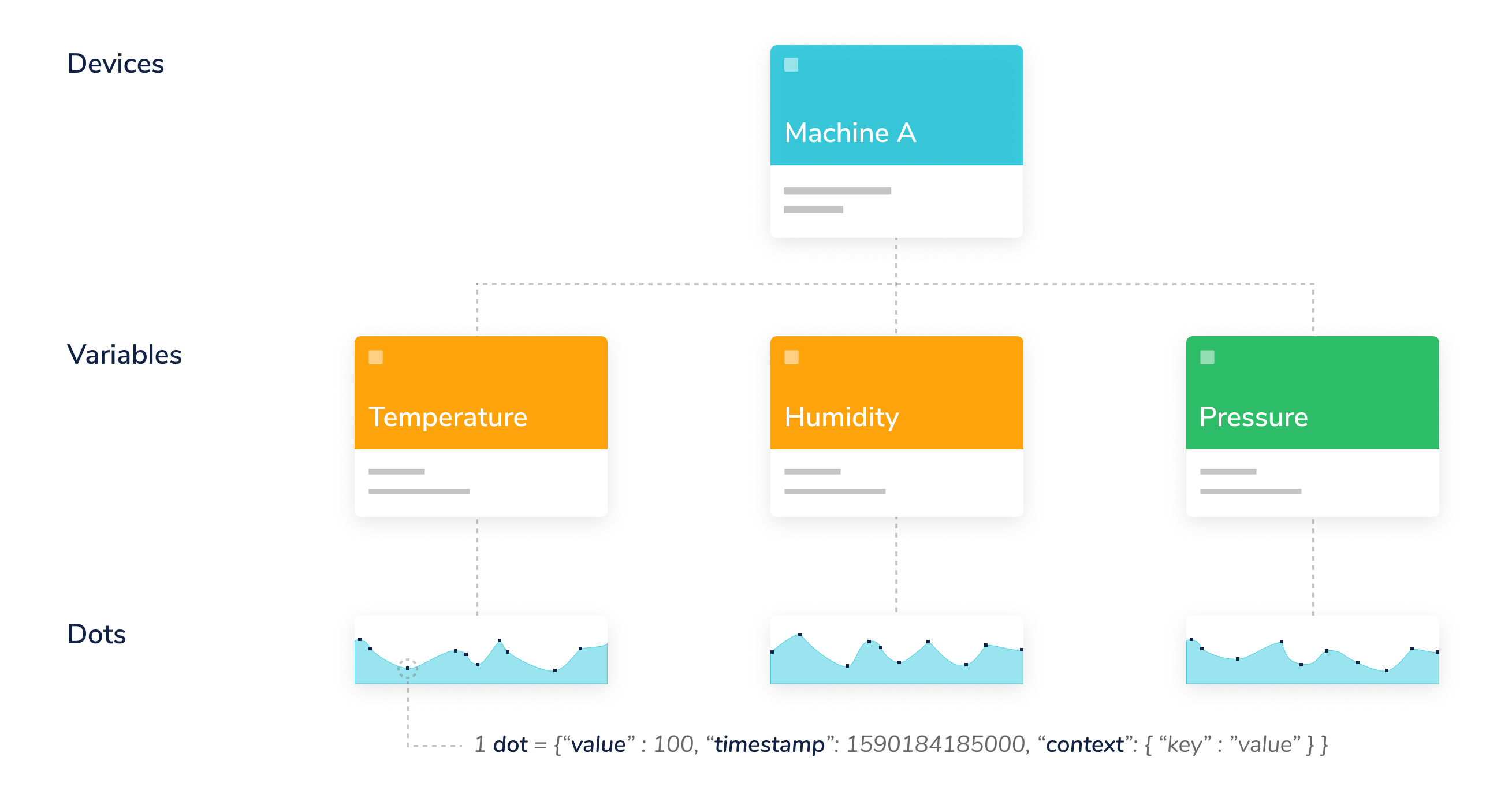
Every time a device updates a sensor value in a variable, a data-point or "dot" is created. Ubidots stores dots that come from your devices inside variables, and these stored dots have corresponding timestamps:

Ubidots Data Hierachy
Each dot contains these items:
| Item | Description | Mandatory |
|---|---|---|
| value | A numerical value. Ubidots accepts up to 16 floating-point length numbers. | Yes |
| timestamp | Unix Epoch time, in milliseconds. If not specified, then our servers will assign one upon reception. | No |
| context | An arbitrary collection of key-value pairs. Mostly used to store the latitude and longitude coordinates of GPS devices. | No |
Values
A numerical value. Ubidots accepts up to 16 floating-point length numbers.
{"value" : 34.87654974}
Timestamps
A timestamp, as best described here, is a way to track time as a running total of seconds. This count starts at the Unix Epoch on January 1st, 1970 at UTC. Therefore, the unix time stamp is merely the number of seconds between a particular date and the Unix Epoch. Please keep in mind that when you send data to Ubidots, you must set the timestamp in milliseconds; also, if you retrieve a dot's timestamp, it will be in milliseconds.
"timestamp" : 1537453824000
The above timestamp corresponds to Thursday, September 20, 2018 2:30:24 PM.
PRO-TIP: A useful tool to convert between Unix timestamps and human-readable dates is Epoch Converter.
Context
Numerical values are not the only data type supported; you can also store string or char data types inside what we call context. The context is a key-value object that allows you to store not only numerical but also string values. An example use of the context could be:
"context" : {"status" : "on", "weather" : "sunny"}
A context is commonly used to store the latitude and longitude coordinates of your device for GPS/tracking application use cases. All Ubidots maps uses the lat and lng keys from a dot's context to extract the coordinates of your device, in that way you just need to send a single dot with the coordinates values in the variable context to plot a map instead of sending separately both latitude and longitude in two different variables. Below you can find a typical context with coordinates values:
"context" : {"lat":-6.2, "lng":75.4, "weather" : "sunny"}
Please note that you can mix both string and numerical values in the context. If your application is for geo-localization purposes, make sure that the coordinates are set in decimal degrees.
